life de |
|||||||||||||||
© 2014 by karin & claus heinze |
|||||||||||||||
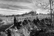
high peak district |
|||||
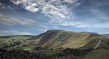
High Peak District: A small chain of hills between the both metropolitain areas of Manchster and Sheffield. |
 |
 |
 |
 |
 |
 |
 |
 |
 |
|||||||||||||||
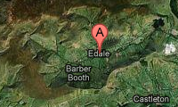
photo © googlemaps |
||||||||||||||||||||||||
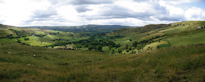
photo © peakdistrictinformation |
||||||||||||||||||||||||
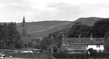
Edale |
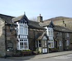
Old Nags Head |
|||||||||||||||||||||||
Wandern |
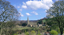
Hathersage und Robin Hood |
|||||||||||||||||||||||
A small village sourrounded by an u-shaped chain of hills. Only a single road and one train track make the connection to the outer world. We arrived Edale by hiking starting in Castleton. |
THE Pub in Edale. Nowhere else you will get such a tasty Stue. A famous Hikers Bar also belongs to the pub, because ... |
|||||||||||||||||||||||
... Edale is the southerly starting point of the "Pennine Way" which finally ends in Scotland. |
This Town is located round about 9 miles west of Edale. Here you can't find only the one and only cash mashine of this area. At the crematory of Hathersage's church you can find Little John's grave! |
|||||||||||||||||||||||